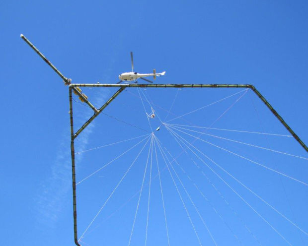
In an upcoming groundwater survey operation, scientific equipment is towed about 100 feet below a helicopter in a 'spider web' array and is designed to map geologic structures beneath the earth. The helicopter will be manned by experienced pilots who are specially trained for low-level flying with this equipment.
Courtesy Photo
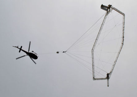
In this 2013 photo, aerial mapping of groundwater a Danish crew with the company Skytem took off with its sensor equipment near Valparaiso. The gear produces a detailed three-dimensional map of the geology of the area, which will include the location and size of ground water aquifers.
Southeast Nebraska residents should not be alarmed if they see a low-flying helicopter over areas of the Lower Platte South Natural Resources District (LPSNRD) in late March or early April.
In an upcoming groundwater survey operation, scientific equipment is towed about 100 feet below a helicopter in a 'spider web' array and is designed to map geologic structures beneath the earth. The helicopter will be manned by experienced pilots who are specially trained for low-level flying with this equipment.
In this 2013 photo, aerial mapping of groundwater a Danish crew with the company Skytem took off with its sensor equipment near Valparaiso. The gear produces a detailed three-dimensional map of the geology of the area, which will include the location and size of ground water aquifers.